|
|
 |

Courses >
| Weather Routeing
Entry Criteria: Mstr and C/O, Sr. 2/O with supeior CoC
Duration (Theory Only) : 2 Days

Course Description
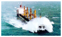
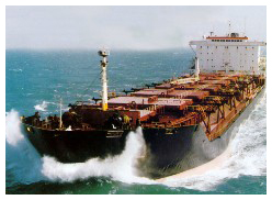
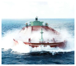
With today's fast turn around of ships and increased pressure on meeting ETA's, it is important for ship's officers to correctly plan and weather route the ships optimally to arrive at the destination in time with no damage to ship and cargo.
"Weather routeing is an application of Meteorological & Oceanographical data extrapolated to give a forecast for the most favourable route for Ocean crossing by surface craft"
Course Objective By the end of this course the candidate should be able to: -
- Read weather maps and analyze the prevailing weather.
- Understand the relationship between surface pressure, temperature and wind.
- Forecast the weather expected in the near future.
- Predict the movement of weather systems such as lows, TRS etc. so as to be able to take avoiding action in time.
- Route the vessel optimally utilizing data obtained from routing charts, 'Ocean Passages of the World', weather facsimile charts, weather reports,
- avarea warning and visual observations.
- Utilize the advice provided by commercial ocean routing services to best advantage.
Contents of the course
- Weather Systems - General Pressure Wind and Current Distribution.
- Weather Nomenclature and facsimile chart symbols.
- Pressure systems - development and movement of depression, storms.
- The Weather Forecast.
- Weather Routing of ships - the mechanics.
- Weather Routing from shore - ocean routing agencies.
top
| | |
| | Please find below the list of documents required to get on the first day of the classroom course.- 2 passport size photographs,
- Copies of Passport, CDC, COC & INDOS No.
|
|
 |